


Storm last week produced confirmed EF1 tornado
A weather system that produced several strong thunderstorms and reports of high velocity winds also apparently produced at least one tornado in Clinton County last Monday night.
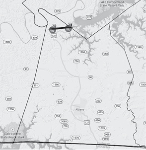
According to the Louisville office of the National Weather Service, the incident occurred at 6:13 p.m. Monday in the northwest corner of Clinton County, near Lake Cumberland.
The affected area is near the Clinton and Russell County boundary and in the vicinity of Grider Hill Dock and Wolf Creek Dam.
No damage to either of those locations was reported, however.
According to the NWS, the affected area included a path that was 2.3 miles long and some 150 yards wide and included several snapped and uprooted trees that were found in a “skipping pattern” over the path of the tornado.
The report also noted that the only non-tree damage that occurred was to several utility poles on the west side of U.S. 127.
It was also noted that a couple traveling in a vehicle on U.S. 127 were unable to continue their route when trees fell across the highway in front and behind them, forcing them to wait until road crews removed the trees from the roadway.
The NWS estimated that damage amounted to about $3,000 in monetary value.
In all, the tornodo event lasted just about four minutes, and was rated as an EF1 on the Enhanced Fujita Scale with likely wind speeds of 105 miles per hour.
The EF1 rating is the second weakest on the scale that ranges from an EF0 with wind speeds between 65 to 85 miles per hour, to the strongest rating of EF5 which involves winds that are in excess of 200 miles per hour..
The NWS also noted in the report that the agency had provided an 11 minute lead time to the storm, noting that a Tornado Warning for the storm had been issued some 11 minutes before the tornado touched down.
This map, issued last week by the National Weather Service office in Louisville, shows the short path that the agency says was affected by an EF1 tornado that touched down when a storm system moved across Clinton County last Monday evening.